For my new blog about Old Roads in Northern Gwynedd go to johndinorwig.vivaldi.net
Travelling by train again
For various reasons it turned out to be impracticable for family to come and see me at half term, so it was agreed I would go and see them. That means a 160 mile journey to Leeds. I was reluctant to drive, as anyone acquainted with the M60 and M62 over the Pennines will understand, so went on my first train journey since January 2020. It’s about a four hour journey on up to three different trains each way. In the past I’ve got various reductions, and the trains have usually been late so I get some of the fare back. No reductions this time, and no late trains either! It involved four different train companies and was pretty straightforward, familiar but strange at the same time. I had a thoroughly good time, and have learned how to read with a mask on, just tilt glasses over the bridge of the nose. Works when you’re still, not quite so well when moving.
So this seems the appropriate point to say that now lockdown is pretty much over, it’s time to bring this blog to a close. It will stay up for a while for anyone who wants to catch up with it, and I will in due course start a different blog about old roads in Gwynedd. I have to pull together a lot of material to do that, and will provide a link when it is up and running.
Regards to all
Unesco world heritage site
An application was made some ago to Unesco for the Slate Quarries in Gwynedd to become a world heritage site. Here are some comments I have just made to a local consultation on the subject
“A neighbour has forwarded to me your correspondence about a consultation in Dinorwig regarding the Unesco application, of which I acquired a copy some time ago. My internet connection (4G but sometimes 3G) is not robust enough for me to participate in Zoom meetings, but here are some observations which you may (or may not) find useful. I will also publish them on my blog, www://johnbyde.vivaldi.net, or do a web search for “Lockdown on a Welsh mountainside”.
I was surprised you had as many as 93 responses, given the current circumstances. You refer to a questionnaire, though it never reached me, so it obviously didn’t cover the electoral roll. And not every resident has internet access. It struck me that most of the responses were rather parochial in nature, the sort of issues that might be discussed in a community council meeting, though I’m not aware of such a facility in Llanddeiniolen. And are not directly relevant to Unesco. I did of course see the signs recently put up by the council at the bus terminus, and made a web search to find out more about them. I note that the community council’s website is in Welsh only, which I guess is technically illegal, and certainly implies that non-Welsh speaker residents like myself are not expected to take an interest. Fortunately Google translate came to my rescue, more or less. The signpost to Llanberis is for a path that is in daily use, myself included, but is not actually a right of way, as you will see if you consult Ordnance Survey or Council maps, I had intended to make an application for it to become one when lockdown intervened.
Issues of wild camping and human waste generate a lot of emotion. Personally I don’t see it as very different from dog waste which is all over the village and the upper end of Padarn Country Park, and indeed sheep faeces which are also everywhere because the fences and walls are no longer maintained. I regularly have to clear the access to my house of both of them
Let me suggest a more ambitious proposal for the area which could be relevant. Road access to Dinorwig is via Deiniolen and Gallt y Foel, a road which I think is almost unchanged since it was built by the Vaenol Estate in 1812. It’s potentially a hazardous process because of the number of residents’ cars parked on it, and the blind bend at the top of Gallt y Foel, where I have had to reverse many times because of a bus or large vehicle coming the other way. The solution is relatively easy, use the modern access road to Marchlyn Mawr built for the power station as far as SH59406313, then rebuild the road along to Dinorwig to S2 standard, providing off road parking where necessary.
Even more ambitious in the long term would be an electric train service every half hour from Chester to Bangor, with a matching bus service to Deiniolen/Dinorwig/Llanberis. Currently it’s near impossible to get to Dinorwig from a distance by public transport, as I know from picking up my daughter from the train “in the old days” before lockdown.”
Another red letter day
Wednesday 10th March
Another red letter day since I had an appointment for the second dose of the Pfizer vaccine at Bangor university at “0906”. That time left me a bit anxious, so when I woke up at 0550 I decided I might as well get up rather than doze fitfully. I bake my own bread nowadays, slicing then freezing it. Found I only had a very small quantity left for breakfast toast. Then surveyed the state of the world on the internet, noting that quite a stormy day was forecast.
Left the house in the rain at 0735, got to the supermarket at 0800 for my weekly shop, left again at 0830 and arrived at the vaccination centre at 0845. Parked nearby and went through very smoothly. Out at 0945 and went to a local store which had some kiln dried hardwood still in stock, loaded up with about 100kg of it, took it home and unloaded it again. Baked another loaf, had lunch, lit the fire and dozed for about an hour to make up for the early start. No side effects of any consequence.
An eventful couple of days
On Thursday 28th January, I had booked my car in for a service and MoT test at Halfords in Bangor, who know the car well. As it is twelve years old, there is always a degree of suspense about the outcome, even though it has clocked up less than 3000 miles in the last twelve months. Under current restrictions they do not of course wish you to hang around, so I planned to walk over to Menai Bridge, and then to Waitrose supermarket on the far side, which I normally visit once a week. I have driven across the bridge hundreds of times over the years, but never walked across, so this was an opportunity to do that. I always think you never really know a locality until you have explored it on foot. That was certainly true on this occasion, you just don’t register the enormous impact of this bridge until you cross it on foot. Of course, the walkway is well supplied with signs encouraging those contemplating suicide to phone the Samaritans, since jumping into the Menai Strait here is a regular occurrence and always fatal.
Having reached Waitrose and put some items in a basket, I couldn’t find my wallet. Went through the usual routine of checking every one of eight pockets without success, so had to return to Halfords with my rucksack still empty. Although the original service etc had been prepaid, there was an additional bill because of a vital but quickly remedied MoT failure, but how do I pay for it? It transpired that Halfords have the capacity to take payment on a “customer not present” basis, and I had the capacity to remember the necessary figures from the card, so I was able to take the car home.
Three hours later they phoned me to say that my wallet had been found in their car park by a customer and handed in, intact, so I arranged to collect it the following morning.
Twenty minutes after that a call centre offered me a Covid 19 vaccination at the University sports centre in Bangor, “you can come now if you want”. I felt I had had enough for one day, and made an appointment for the following morning.
The background to this call is that postal services here have been seriously disrupted by a Covid19 outbreak at the local delivery office, with relief workers being brought in from 70 miles away. The local NHS had been made aware of this, and my surgery had provided the phone numbers of eligible patients to the vaccination centre. Recent bad weather here had already disrupted the appointments system, and since most vaccinations here are of the Pfizer vaccine which has a short useability life after coming out of specialist freezer storage, there is an urgency about using the phials before they have to be thrown away.
The University sports hall, known as Canolfan Brailsford after a local cycling champion, was fitted out early in the pandemic as a “Nightingale” hospital (Enfys is the Welsh designation) although never used as such. So Friday morning I collected my wallet from Halfords at 0805, did my usual shop at Waitrose, which is virtually deserted at that time in the morning, and got to the Sports Centre a bit early for my 0915 appointment. Packed with nurses and volunteers managing a socially distanced queue, and progress was a bit slow. Like waiting to see Father Christmas, I commented. The actual injection was from my point of view just the same as a flu jab and I was able to leave just after 1000. It was interesting to see the layout as an emergency hospital, the same as I have seen on TV from time to time. No noticeable side effects so far, and I have “paid forward” the fact my wallet was handed in intact (including £20 in cash) and that I have had my first jab, by making a donation to the Samaritans.
Although it will make no immediate difference to my behaviour in lockdown, it did feel like a valuable New Year present, and reflects the enormous amount of work that the UK has facilitated to make vaccines possible.
Nearly back to square one
So we are back to a full lockdown, with the significant difference that vaccinations are starting to happen even up here. With a predominantly white and elderly population locally, take up is likely to be high, as it has been with the flu vaccine.
As well as my usual activities, this is a time of year when I have to invest quite heavily in wood fuel for my solid fuel burner, which provides both hot water and central heating. There has been quite a lot of publicity about the disadvantages of wood fuel stoves, but I have always bought kiln dried wood, and this year increasingly heatlogs . Delivery can be a problem when you live at the bottom of a private track which is itself at the bottom of a steep narrow dead end lane, but I have worked out ways of getting supplies into the back of the car . Loose logs are far too much effort, so I buy bags or nets of various kinds, which I can get into the house from the car by wheelbarrow. A good keep fit exercise in itself. In North Wales there appears to have been a big increase in demand this winter, but I have now got enough to last me until the Spring. If I had known 20 years ago what I know now, I would have set up an air or ground source heatpump, but that’s idle speculation until the system needs replacing.
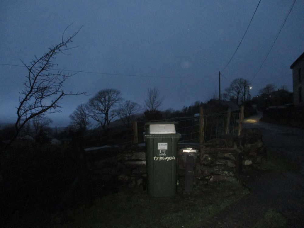
It is not only bulky items that can generate delivery issues. Like so many others, I am making more use of orders online. Drivers under pressure can resort to several strategies to avoid coming down to the house. This was one delivery of frozen meat recently, a polystyrene box put in the top of my wheelie bin, by my letter box, a hundred and thirty metres from my house. Fortunately I had an email confirming delivery, but had to walk up and collect it in the dark and the rain, before the bin was emptied the following day.
When drivers do take the trouble to come to the house, they can arrive in vehicles too large for the purpose, and have trouble getting back to the road. One recently tried to reverse up, but only the post van and its regular driver has the expertise to pull off that trick. This driver had to call for recovery before I was able to get him down again and turn round to get up frontwise. Some damage to the track resulted. Occasionally a driver will realise that he can’t get down, and spends five minutes walking down with the consignment. The most extreme delivery last year was of three small electrical items which came in a virtually empty 18 tonne van.
Christmas Day 2020
With a family stretched across North Wales, Leeds, and Edinburgh , we made a collective decision some weeks ago to stay in our own little burrows for Christmas, regardless of the ever changing governments’ guidance on the subject, so we made no plans to meet up and were not disrupted at the last minute. The decision was made easier for us by the prospect, even if some weeks away, of a vaccination for the older members.
To compensate a little for not being able to see children and grandchildren, I put energy into food planning, which has taken up a significant amount of time in the last few months. For today’s lunch I had prawn cocktail, mallard breast fillets with a cranberry and port sauce, roast potatoes, Christmas pudding and cream, and some Rose wine grown ten miles from here at Pantdu. The other items resourced from my local Waitrose, Wiltshire game, and Donald Russell in Aberdeenshire.
We will all be hoping that 2021 will be the beginning of the end of all the disruption. Peaceful Chrsitmas and Happier New Year to all.
Terfyn and Lon Garret
Terfyn is a Welsh word derived directly through the Roman occupation of Wales from Latin terminus. Pont (stone bridge), cwrtil (curtilage), caer (castra, fort) are similar examples. In the context of Dinorwig it is the name of the highest formerly occupied area on Lon Garret around SH59216174. Garret refers to the highest area of Dinorwic Quarry, which runs to nearly 2000 feet high. The highest house on the Ordnance Survey plan of 1891 was Tan y Garnedd, but by 1914 its name had changed to Tan-y-Garret (ie below Garret) at SH59396150. Almost all of these houses were abandoned by the time of the https://en.wikipedia.org/wiki/Town_and_Country_Planning_Act_1947 planning legislation, meaning they cannot be brought back into use now without planning consent, which is very unlikely to be given. They are in varying states of decay, eg Geograph photos https://www.geograph.org.uk/photo/298175 and 298186. The photographer notes the contrast between the two, usually like mine they are built with random stones picked out of the fields, but what looks from a distance like dressed stone on closer inspection turns out to be stone with a natural straight edge.
A few years ago an anemometer and associated electrical equipment were installed at Tan-y-Garret presumably to test its suitability for a wind turbine: subsequently it was blown down in a gale, which I suppose was sufficient evidence of its unsuitability since it hasn’t been reconstituted.
The farmer who used to own this land, who bought it from the Vaynol estate when it was dissolved in 1947 for a nominal price, was very particular about his ownership and put up various signs (whitewash on slate naturally) stating no road, no entry, etc, which is technically correct, even now this is not land subject to right to roam legislation. He told me some years ago that a property company had offered to buy the properties on a speculative basis, in the hope that planning laws would change, but he declined. After his death the farm was taken over by his son in law, and the signs have eventually disappeared. Basically this is upland hill farming, just a few sheep on poor grazing land.
A few of these houses were still inhabited after 1947, so that planning consent isn’t needed for them to be resuscitated. They include Bryn Goleu at SH52916146, which is reached by a steep rather terrifying track from Lon Garret. It passed through several hands until purchased in 2016 by a retired British corporate lawyer from Dubai who presumably had had enough of the heat; it is now the registered address of his “architectural activities” company, having been extensively renovated after he bought it. Even has mains electricity and a new septic tank nowadays.
Another upmarket property nowadays is Groeslon Uchaf SH5888197 which was bought at auction for £150k some years ago, has been extensively upgraded and is for sale at £495K https://www.rightmove.co.uk/property-for-sale/property-68260851.html.
Lon Garret itself is a public highway as far as the gate leading into the old Dinorwig Quarry, after which it is disused. Parascenders park their vehicles in the small parking area by the gate, and climb up Elidir Fach to jump off and attempt to cross the quarry and Llanberis pass over to the the foothills of Moel Eilio. Otherwise it is used mainly by walkers, and motorists who like to drive up a no through road to see what’s at the end. Occasionally you might get more than you bargained for https://www.flickr.com/photos/hamishfenton/4250818356/in/photostream/. I can remember seeing snow like this 30 odd years ago, but it’s pretty much a thing of the past now. A reminder however of how brutal the climate sometimes was in the nineteenth century.
The road is not shown on the earliest large scale map of the area, OS two inch to the mile drawing of 1818, but it must have appeared soon afterwards presumably to gain access to the higher reaches of the quarry. However, the former presence of a Roman milestone at Caer Bythod SH5645 6360 raises an intriguing possibility. It was found in 1798 and is now, it seems, located at the National Museum of Wales site at St. Fagan’s near Cardiff. There has been speculation about why this milestone was found here, since it is currently about 3 miles from the known Roman road to the fort at Segontium, Caernarfon, which comes from Chester and through the northern end of Llanddeiniolen parish. The find site was roughly at the crossroads between the modern A4244 and a lane running from Llanrug through Penisarwaun and Clwt y Bont. This is direct rather than aligned, although E of Penisarwaun it is “warped straight” and is all but level. After crossing the main road it continues climbing gently until it comes to a steep pitch at 5723 6323. After crossing the Dinorwig Tramroad of 1824 at 5746 6309, the main road bears N up hill, minor road goes straight on, and on S side at 5760 6303 there is Tan yr Henffordd, (“below the old road”) which looks as though it was originally a 2 roomed cottage now much extended. Then again, by Deiniolen Silver Band room, the more used road turns N, and lane goes on and immediately swings through a sharp upstream zigzag over river Caledffrwd (5765 6301). Unusually for a minor road in this area this bridge was built up from 2 central piers, rather than a simple arch or horizontal slabs. It was washed away in a flood some years ago, and has now been replaced by a modern construction. There were also slight traces of edge-on paving below the bridge on N side. At 5795 6294 the road veers N round a mound of earth, but the S field wall goes straight on, and there is an old opening for a wicket gate in it halfway along the line. All this stretch from the main road, through what is now the village of Clwt y Bont, and including the zigzag, appears on the Llanddeiniolen enclosure award of 1813 (GAS). On this plan the track then turns abruptly S at 5797 6292, this still exists as a path, the road going straight on is not marked but logically must have been there. The 1818 drawing is similarly the same. A small stream (now culverted) is crossed at 5824 6284, then at 5351 6282 it crosses the road to Dinorwig built by the Vaynol Estate in 1812 and goes very steeply up the side of a tributary of Caledffrwd, where it is known as Lon Bwlch as it climbs to a small windgap at the top. The terraceway is most pronounced at 5862 6254, where a retaining wall some 8ft high is beginning to fall in. Another minor road is joined at 5870 6231 and then continues S but at 5871 6195 there is an awkward T junction and there are no obvious alternatives up hill to the east. We then come to Lon Garrett itself climbing across the mountainside until it disappears under the quarry tips at 5952 6115. It is not obvious why such a line should have been chosen for a quarry road of the Industrial Revolution, when the main C18/early C19 activity is known to have been down below on the Tramroad at Allt Ddu; this upper area of the quarry being as far as is known a later development. It is then referred to by name in a sketch of Dinorwig quarries made in 1836 (GAS Vaynol 4190). Looked at from the opposite side of Llanberis Pass, it is clear the line is the only possible one on the hillside at this high level and has been surveyed to a very regular gradient.
.jpg)
Does this imply there was older quarrying activity up here? There is no way now of getting proof, but the line does suggest the possibility of a Roman “road”, “path” might be a better description, we do know from the fort at Segontium that the Romans had discovered and used slate at least for paving, so perhaps it came from Garret where the beds were cropping to the surface.
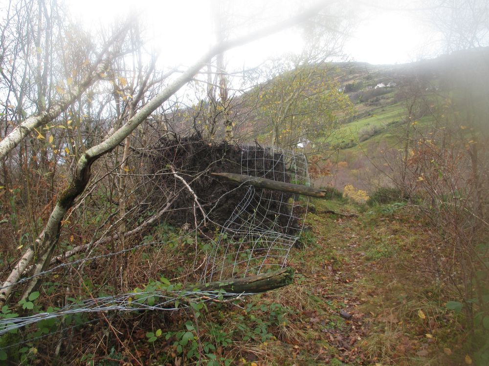
Good fences make good neighbours
The famous Robert Frost poem is actually about a wall not being needed in that particular context, but it repeats a well known phrase in use for centuries. The vision of two landowners working opposite sides of a drystone wall seems rather obsolete from a modern point of view, and I can’t imagine it ever happening in this part of the world. Unlike the regular characteristics of a wall in a limestone area the stone walls in this region were created, with considerable skill, from a most irregular assortment of boulders lying at random in the boulder clay covering most hillsides (which includes glacial erratics from Scandinavia as well as local slate and granite), and would have been very labour intensive. The skills still linger on, and are used occasionally to repair wall or create walls at the roadside, such as this
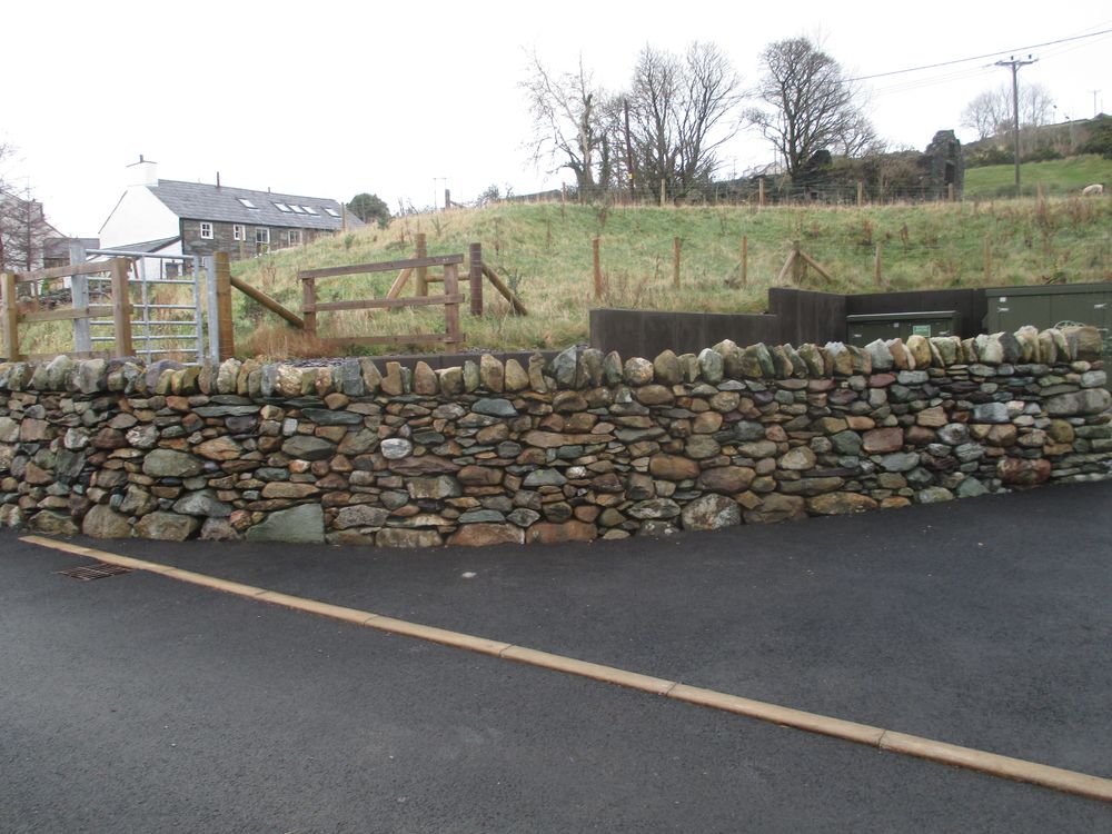
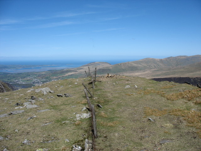
at a recently completed sewage plant in Dinorwig. A close up view would show that this is not truly drystone, because concrete has been discreetly applied to provide more durability. Most of the original walls here are in various stages of collapse, and the universal way of providing boundaries now is the cheap and cheerful system of post and wire, which is efficient in the short term but starts falling apart within 15 to 30 years, at which point it becomes an eyesore. The posts will eventually rot away, but the wire, including the common addition of a razorwire topping, does not of course. Even the mountain tops round here are littered with the remains of fences put up thirty odd years ago, I think there might have been grants for doing it in those days, so you have this at the top of Foel Gras (Geograph 226145)
and various other summits.
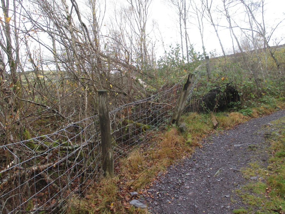
Within a few hundred metres of my home there are examples of fencing that is now past its useability date: none of them are likely to be repaired.
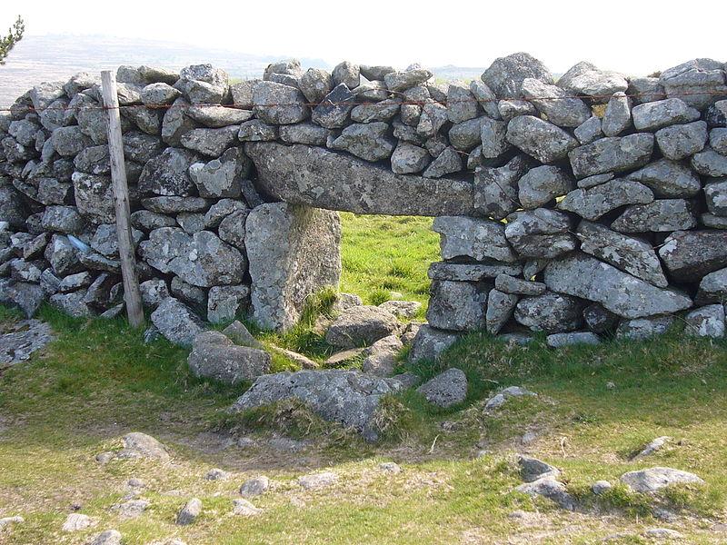
Increasing amounts of this upland land are not so much being rewilded as abandoned. One organization going against the trend is the National Trust, who own Snowdon and much of the surrounding land. The stone walls on their tenanted land in Nant Gwynant are scrupulously maintained, much to the frustration of course of those of us who have lost our way and can’t cross the walls in our path. Some years ago I had to use a sheep creep like this to crawl through such a wall. This particular photo comes from Dartmoor.
The Trust’s tenant farm at Blaen y Nant in Nant Ffrancon near Bethesda has also been the venue for annual walling competitions, as referred to
https://thinking-stoneman.blogspot.com/2018/01/sean-adcocks-continuing-walling-project.html
https://www.thefreelibrary.com/Dry+stone+wallers+battle+to+do+Snowdonia+proud.-a0119896331
There is a third variation known in North Wales as cloddiau http://www.dry-stone.co.uk/Pages/Books/Articles/Cloddiau1.html which combines a stone base with an earth centre topped with a hedge, quite common in the lower land between Bangor and Caernarfon where the supply of stone is not so easy.
Unfortunately these efforts, like footpath maintenance, are becoming a drop in an ocean of neglect.
Return to lockdown
This blog has been rather neglected in recent weeks, owing to various other demands on my time. As lockdown eased, I have been able to get visits from family, including grandchildren, which was very welcome all round. This included a visit from my daughter, the original intention being to run an adventure race which got cancelled at the last minute. She came anyway and her exploits are recounted at planetbyde.com for those of an adventurous disposition. I have also been busy accumulating wood for my solid fuel stove, which runs my central heating. Only use heat logs or kiln dried and early autumn is the time to build up stocks, which I have now completed from a variety of sources, just in time for a “circuit breaker” lockdown to be introduced in Wales, which makes further family visits impossible. So settling in for the possibility of a long hard winter on my own, hopefully I shall survive.
More local stories later.
Collecting that prescription again
Varied the routine this time. After walking down the conventional way, I caught the bus for the first time in months, got off at Nant Peris and walked back up through the fields and quarry to home. The bus was busy because of walkers going to the top of the Pass to climb Snowdon, and a little bit intimidating for that reason.
You then follow the footpath mentioned in my article on the Fachwen estate as a possible old route from Llanberis pass to the Menai Strait. There is a section of the path where an iron bridge has collapsed, and there are council notices telling walkers a to cross the stream at their own risk or “seek an alternative route”. There are alternative rights of way on the map, but as so often happens nowadays, none of them can be found on the ground
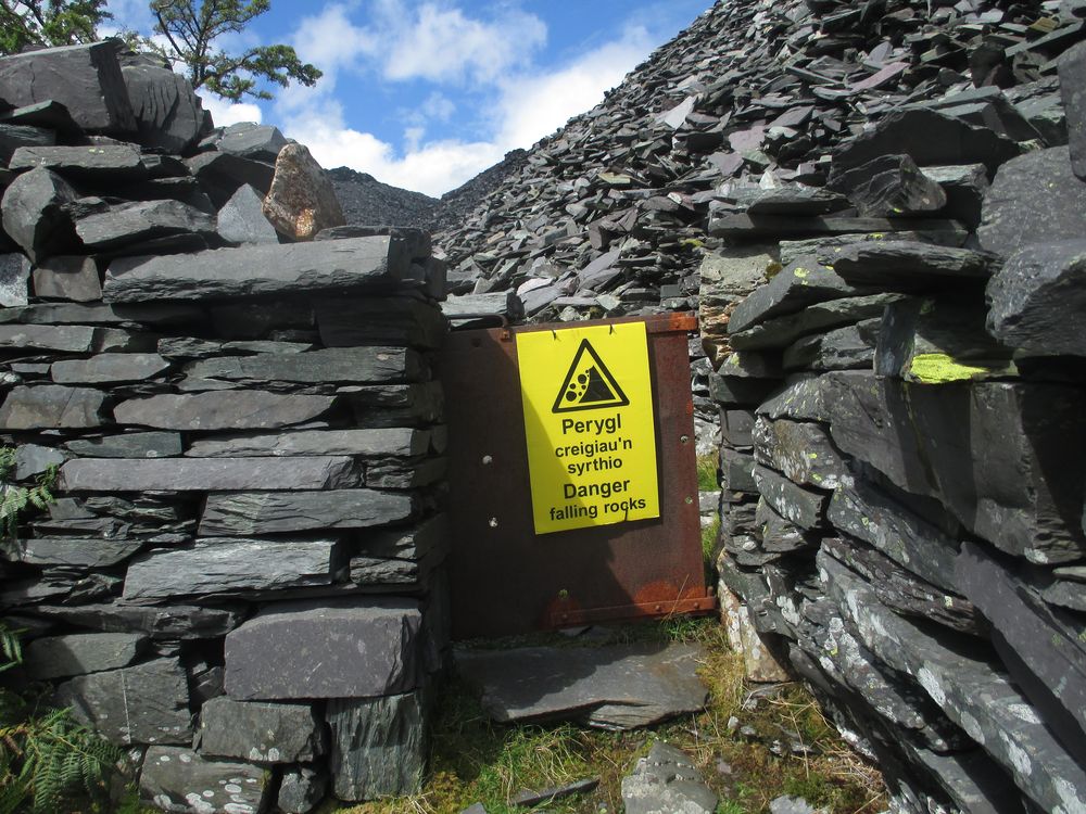
It’s a very pleasant climb up through the fields, with a succession of shallow steps built by the quarrymen from Nant Peris getting to work until you get to the Dinorwic quarry boundary, where there is a cast iron gate of the type frequently deployed in the nineteenth century by the Vaynol estate where footpaths cross a wall or boundary. As you can see, it now boasts a danger sign because as it climbs up the tips, loose slate has slowly encroached upon the path. It’s still useable at the moment, but sadly I doubt whether it will be for much longer.
After that you pass through the quarry pretty much from end to end, by passing through “Watford Gap”.

That this is an old route is evidenced by the fact that a sketch of the quarry made in 1836 shows the horse drawn tramroad from Dinorwic to Moel y Don passing through this to reach the far incline no 3. This still exists but is in a potentially dangerous state, as it is made entirely of unmortared slate blocks which are now sagging dangerously. Notwithstanding this walkers still use it to get up onto the flank of Elidyr Fawr .
A few days later on 26th August we were hit by Storm Francis. The damage here was not as widespread as in many other parts of the UK, but there was a phenomenal amount of rain, 102mm (4 inches in 24 hours), in Dinorwig this shows itself as flash flooding albeit of a minor nature. It leaves water flowing down footpaths leaving them in a rather sorry state, but there’s no point in relying on landowners or the council to clear them up, they have more important issues to deal with, so we deal with the problem as best we can.
Emerging from lockdown
Getting around my part of the world
Transport can be a problem halfway up a mountain. Before the industrial revolution, you walked. Or if wealthy enough, you owned a horse. If a farmer, you might have a horse and cart. It was normal to walk three or four miles to work in the slate quarries, and three or four miles back. The advent of the railways increased the possibilities in some locations.
Most of the roads in this area were created in the nineteenth century; a few routes would have been developed from packhorse trails (see my article on Fachwen history). Then more to allow slate to be taken to the sea in Caernarfon, Port Dinorwic (now Y Felinheli), or Penrhyn Quay in Bangor. By present standards they are single track with no centre white line. Villages like Deiniolen or Llanberis have pavements for pedestrians, but Dinorwig does not. The most modern development resulted from the building of Dinorwig Power Station in 1974, which necessitated an extensive modernization of the main access roads to accommodate heavy goods vehicles.
The introduction of the internal combustion engine led to lorries, cars and buses, but as vehicles get larger the roads, with a few exceptions, do not. Unlike the Scottish highlands, few specific passing places were created, so meeting another vehicle on a single track lane requires negotiation. A few years ago an oncoming car refused to back down, which would have been good manners in the circumstances, forcing me to reverse some distance up a steep narrow lane, resulting in my clutch burning out and the most expensive repair bill I have ever had. You are also sharing the road with pedestrians, cyclists, horses and inevitably on occasion in Wales sheep, so you need to be alert.
There are bus services in the area, which have a chequered history. Three local companies have gone bankrupt, and in two there has been fraud on claiming payments for bus passes extensive enough to result in substantial prison sentences. Despite public support services here are hanging by a thread, and their future is uncertain.
There are of course taxi firms, but even these are diminishing as demand goes down, and those that survive outside towns like Caernarfon and Bangor are increasingly dependent on the tourist trade. Being able to drive a car, or have the use of one in the household, is increasingly a necessity. You have to be fit and healthy to use a bicycle hereabouts, although the advent of electric cycles will open up another option for some.
Origins of tourism in North wales
I have recently come across two websites about the origins of tourism in North Wales.
https://curioustravellers.ac.uk/en/about-the-project/ which details the results of a four year research project on previously unpublished tours of Wales and Scotland in the late 18th and early 19th centuries. The common factor is the journeys of Thomas Pennant of Whitford in Flintshire, who as a relatively wealthy gentleman of leisure, travelled extensively in both Wales and Scotland. These early tourists, of both sexes, were hardy individuals who sometimes travelled alone and on foot.
A spectacular example was William Hutton whose Wikipedia entry states “is generally held to be the first person in modern times to walk the entire length of Hadrian’s Wall, twice, producing an account of his 1801 journey in The History of the Roman Wall.[3] Walking 600 miles from his Birmingham home, along the wall, and back home again, he wrote in the preface, “I have given a short sketch of my approach to this famous Bulwark; have described it as it appears in the present day, and stated my return. Perhaps, I am the first man that ever traveled the whole length of this Wall, and probably the last that will ever attempt it” I’ve only glanced at the book, but looks as though he travelled solo, taking five weeks in the summer, walking an average of 20 miles a day. and spent 40 guineas, very roughly £3000 in today’s terms, on food and accommodation, often of a very primitive kind. He was 78! and lived to 91.
Another transcription is from the diary of Ann Lister. who featured in the TV series Gentleman Jack last year https://editions.curioustravellers.ac.uk/pages/show.html?document=0023.xml. She and her aunt went on a tour of Wales, and after staying at what is now Plas y Brenin, on 15th July 1822 they climbed Snowdon with a guide in 3.75 hours via the Miners track, met up with one or two others who drank copious amounts of brandy at the top, then came down by a “very difficult route” to Llanberis. Presumably therefore not the Llanberis path, which did exist at the time, the only other possibility is via Cwm Glas Mawr, which even now is considered difficult and little used. Especially if you are unwell and have had a few glasses of brandy….
https://sublimewales.wordpress.com is another extensive site, in which William Hutton appears again – there is a lengthy account by him of climbing Snowdon in 1799. His daughter also came to North Wales a few years later.
William Bingley is another writer who visited Wales on several occasions, a young cleric at Cambridge who took a coach to Chester and then walked around North Wales in the long vacation of 1798. His book Tours in North Wales can be viewed and downloaded from University of North Carolina. The painter JMW Turner also travelled to Llanberis and started the now very famous and popular tradition of painting and photography from the bridge (built in 1825) at the northern end of Llyn Padarn near Llanberis.
There are many other examples now accessible through these modern digitisation initiatives. It’s worth recalling that this flowering of tourism in Wales by people of leisure coincided with the Napoleonic Wars, which meant that the grand tour of Europe popular with an earlier generation had come to an end.