Electric Mountain is a large pumped storage scheme initiated by the National Grid in 1974, when it was still in public ownership. It was one of the largest civil engineering projects in Britain at the time, and is still functioning nearly 50 years later The underground power station is huge, and in normal times open as a popular tourist attraction, even attracting overseas visitors. The vast cavern in which it is built is almost underneath my house and I have been on the tour several times over the years. It works by pumping water uphill from Llyn Peris to Marchlyn Mawr using off peak electricity, then running it downhill to generate electricity when needed. Nowadays it is more a standby than regularly used, since flicking the switch can generate a lot of energy within a few seconds. Unlikely to be built nowadays with the development of mass storage batteries but still functioning as intended.
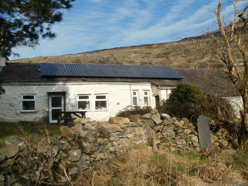
Renewable energy round here nowadays consists of solar panels both
domestic and commercial and micro hydroelectric schemes. There are at
least eight of the latter within a 10 mile radius of here, in the
National Park and near invisible once constructed, here is a
commercial venture on the flanks of Snowdon which earns thousands of
pounds a year – a power station with a turf roof
On
a more modest scale, the introduction in Britain of a feed-in
tariff scheme in 2010 offered considerable incentives for long
term investment, and five owners in Dinorwig took advantage of this
including myself.
The initial cost of the installation was £12000, and as predicted
after 8 years I have recovered this cost. With the prolonged sunshine
in April and May the panels has earned a record £935 for the quarter
just ended. There is another 17 years of the scheme to run, which
will return a profit of around £25000, although I’m unlikely to
live long enough to gain by it myself, in which case the remaining
profit will belong to a future owner. The scheme was run down over
the years and has now closed, although there are still potential
returns for commercial solar farms, one of which is a few miles away.
OLYMPUS DIGITAL CAMERA
Last year I had battery storage installed, a relatively expensive undertaking, partly to maximize my use of the electricity generated, partly as an insurance against mains power failure, which still happens occasionally – the grid is much more robust here than it was 40 years ago, when almost every gale led to a power failure – but with overhead wires even an adventurous squirrel can lead to interruption (and a dead squirrel). Since I don’t have gas, that’s a nuisance when cooking dinner.
I’ve also made a modest investment on behalf of my grandchildren in
renewal energy cooperatives in the UK.
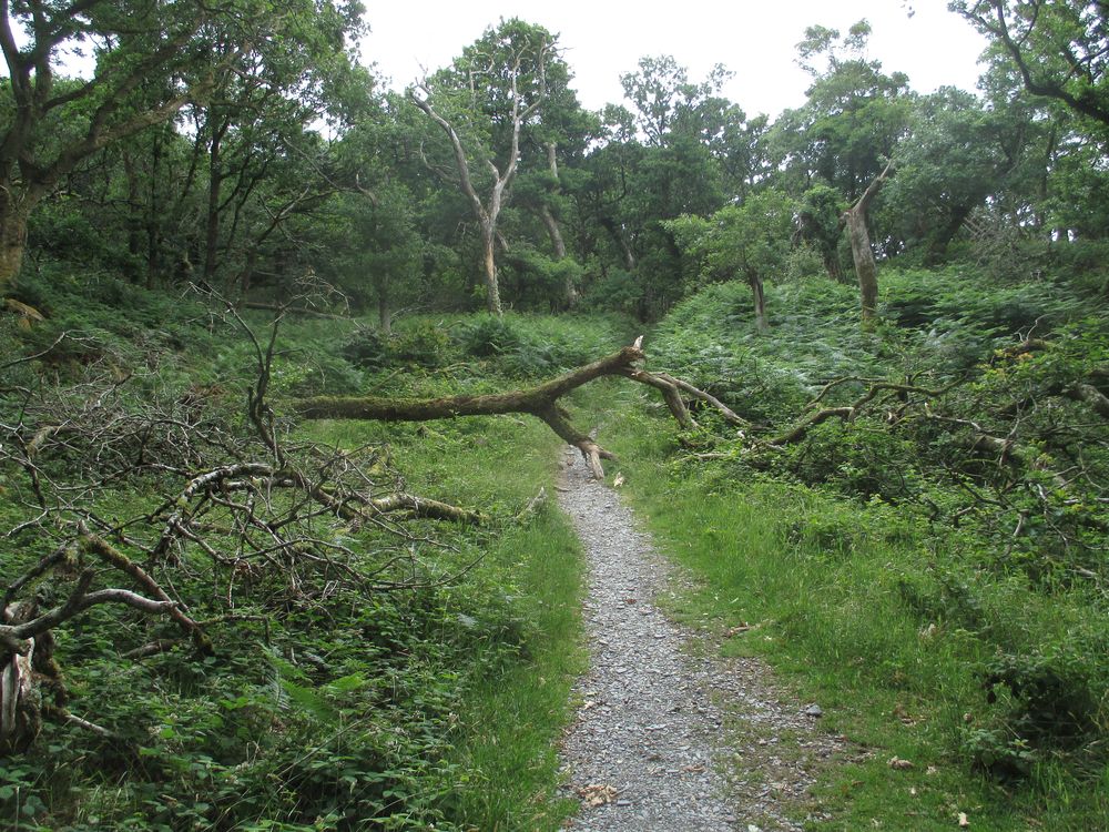
One
of the consequences of the “Beast from the East” here in March
2018 was that at least a hundred of the sessile
oaks that are a distinctive feature of Padarn
Country Park, and make it a site
of special scientific interest, were uprooted, there being very
little soil and a great deal of slate bedrock on this hillside. From
time to time a relatively modest wind now will bring down more trees
that were destabilized at the time, and on 17th
June this came down across one of the well used paths in the
woodland.
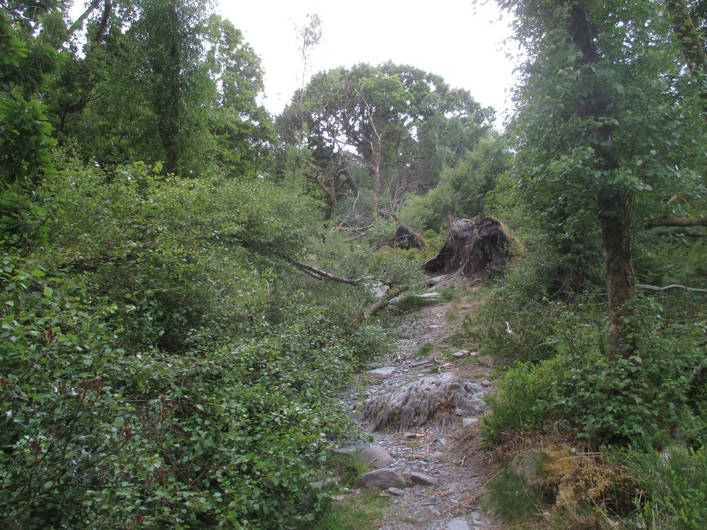
There had been another casualty on the same path a few hundred metres
away in May
but
this had been partially cleared by local walkers and was of less
consequence.
Since the more recent fall was a larger tree and not very stable, I emailed my local councillor and the country park Warden on 22nd June, not being too optimistic that they could do much about it under current restrictions, but they have responded very promptly, and by this morning it has been cleared. Good to know that some of the less high profile work of local government can still be carried out.
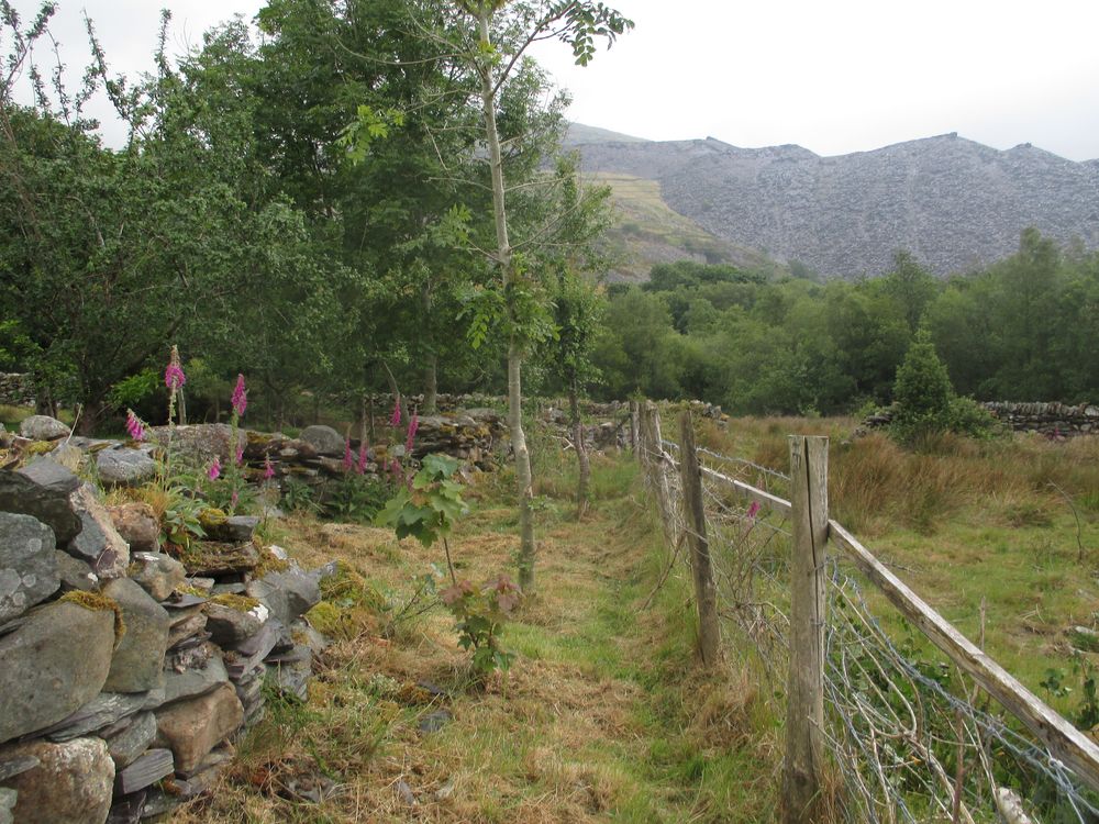
Within the main wooded area too many brambles and feral goats have
inhibited the regeneration of these trees, but in more open areas
there are lots of saplings, and I even spotted one on my own land
recently
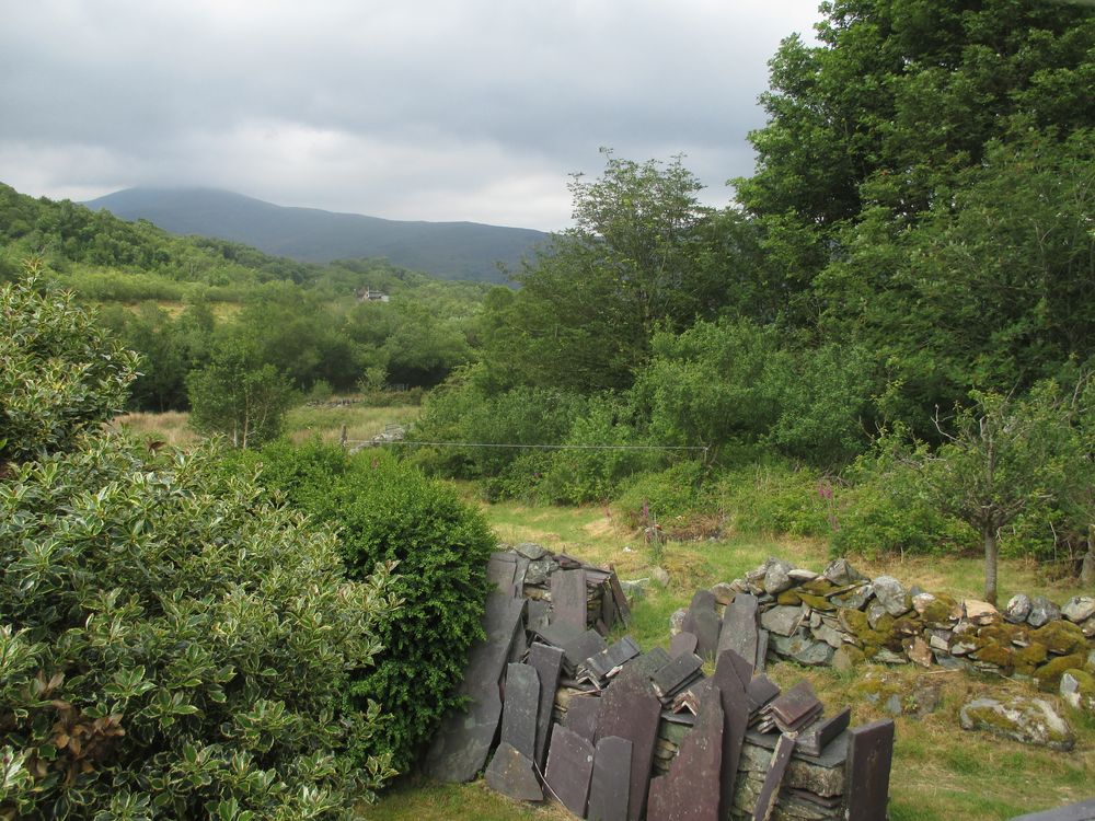
This
view from my bedroom window shows how much woodland can now be seen
here compared with forty years ago – less sheep grazing off new
shoots, plus some deliberate planting. It’s a real privilege to be
living here.
This is a substantial western
outlier of the Glyderau range, rising to 396 metres (1303 feet). It
is outside the Snowdonia National Park. It was formerly a grouse
shoot of the Penrhyn
Estate, and was surrounded by a substantial
stone wall, to keep the grouse in and the plebs out. Nowadays the
wall has been breached and it is open
access land, as shown on Ordnance Survey 1:25000 maps.
From the east it is just a minor
hill, from the coast and Bangor
it dominates the landscape.
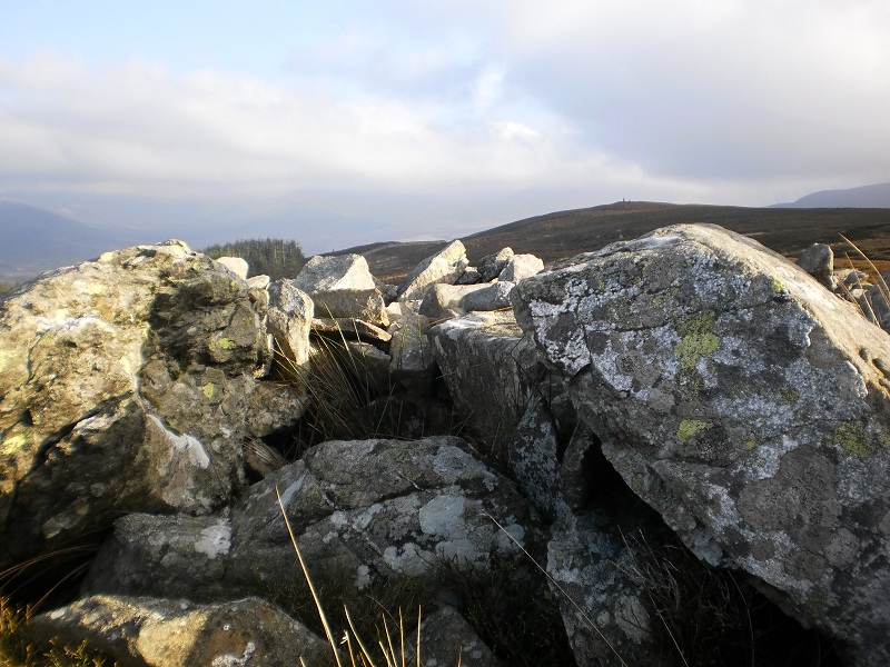
A large cairn, 14m diameter and up to 1.4m high but well spread, with
an Ordnance Survey trig pillar on top. It is built of quite heavy
boulders requiring great input of effort so is unlikely to be just a
walkers’ cairn. The platform-like shape may have been created when
the trig pillar was built. About 2m N of the trig pillar is what
looks very much like a robbed cist and 0.6m deep with 3 sides formed
by upright slabs and a thicker slab lying over these to the S,
probably a moved cover slab. The slabs are too large and embedded to
have been built by visitors. A fair amount of the cairn has been
robbed to build a circular shelter on the NW and there are 3 small
outlying recent summit cairns. The cairn is built on the W promontory
of the summit plateau, which is the apparent summit or false crest
when seen from the nearby lower land to the NW, whereas the actual
summit is further to the E. This is good evidence that the cairn
belonged to settlement lying in that direction.”
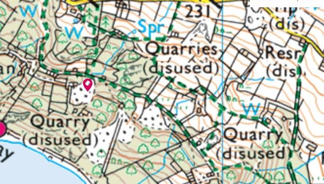
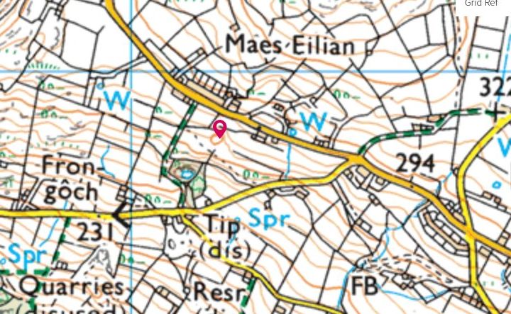
These notes refer to an eighteenth century estate called Fachwen and
owned by Lord Newborough, an extension to it to the north and east
when common land was enclosed in 1814, and its absorption into the
Vaynol estate by purchase in 1840. It is located on the eastern side
of Llyn Padarn opposite Llanberis, in North Wales. The Newborough
estate, sometimes known as Glynllifon,
the name of Lord Newborough’s residence, also owned most of the
land around and above Llanberis on which quarries such as Glynrhonwy
were extensively developed in the nineteenth century.
References:
Collation of information obtained from an examination of Gwynedd
archives in April and May 2003, together with an examination of 19th
C Ordnance Survey maps, and some research in the field.
1797 = Evans J – Map of North Wales (ca 1797)
1818 = Ordnance survey drawing 2in/mile in British Library cat no
306. Available on line.
specifically
https://visionofbritain.org.uk/maps/series?xCenter=3093196&yCenter=3007352&scale=63360&viewScale=11338.5888&mapLayer=nineteenth&subLayer=first_edition&title=Ordnance
Survey and Ordnance Survey of Scotland First Series&download=true
1891 = Ordnance Survey 6in/mile 1st edition 1891.
B = James Bransby – A description of Llanberis & the Snowdon
district (1845) (Caernarfon public library)
L = John Leyland, Itinerary in Wales 1536-1539, as ed L T Smith
1906 p79 (Caernarfon public library 914.2964.52)
DinD = Douglas Carrington – Delving in Dinorwig 1994
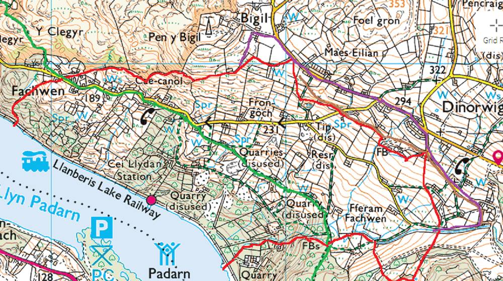
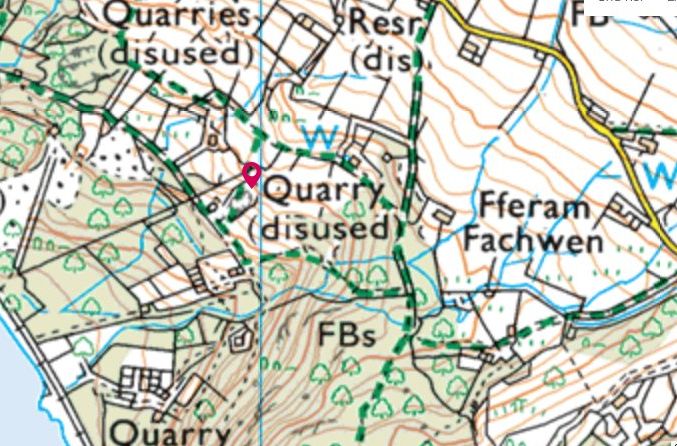
Land
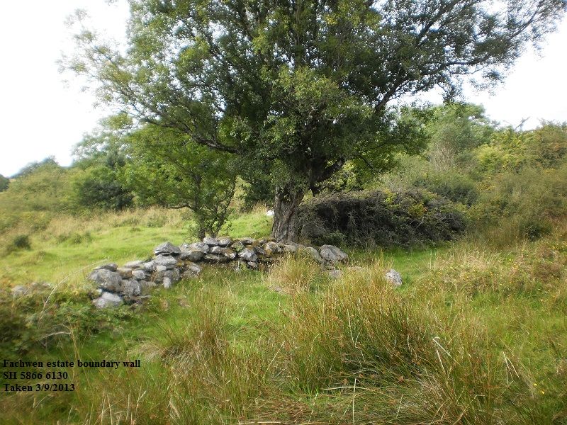
The approximate boundary of the original Fachwen estate is shown in
red, information derived lfrom the enclosure award of 1814 and tithe
map of 1840. It was originally about 240 acres. There are still walls
in some places, but in others there is no trace now on the ground.
The purple line surrounds the addition of 60 acres made to the estate
by the 1814 enclosure
award. Ruined remnant (original northern boundary) illustrated.
OLYMPUS DIGITAL CAMERA
Packhorse trail described below at “Allt Wen” is marked in
green
Packhorse trail described below at “Lon Capel” is marked in
brown.
The earliest reference in Gwynedd archives shows that in 1763 the
“messuages, tenements and lands called Fachwen, pa.[rish]
Llanddeiniolen” pass into the ownership of the Glynllifon estate
(subsequently Lord Newborough) for £4089. The 1840 tithemap of
Llanddeiniolen shows the whole estate boundary in its pre 1814 form.
Some of it also appears in a Vaynol estate plan of 1777. The
Llanddeiniolen enclosure award of 1814, increases its size on the
northern side by 102 acres.
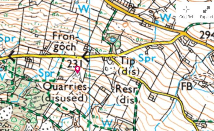
Communications
Getting slate to market was a major issue for any quarry operation.
The Vaynol estate had commissioned a “cart road” built in
1812, which is the present main road up to Dinorwig. It is therefore
shown on the 1814 enclosure award and the 1818 OS drawing. It has a
semi circular diversion at Chwarel Fawr (eliminated by the 1980s
landscaping) which shows that that quarry must have been large even
then.
Later the upper part of this road became also the line of the 1824
Dinorwig Railway, a horse drawn tramroad which ran down to Clwt y
Bont on a double incline, still in existence although rather
overgown, and then across the coastal plain to Nant y Garth and
another incline down to Port Dinorwic. (DinD ch3). It is shown on the
OS map of 1840 although very little now remains.
In 1836 (DinD ch5) James Spooner, a surveyor who had already designed
and built the Ffestiniog Railway (see
http://en.wikipedia.org/wiki/The_Spooners_of_Porthmadog)
was commissioned by Thomas
Ashheton Smith to survey a new route from his quarries to Port
Dinorwic. The survey survives at Gwynedd archives Vaynol 7142. This
was for a railway halfway up Allt Wen and contouring round the hills
in the same general line as the packhorse trail and eventually coming
out, like the existing road and horse drawn tramway, at the top of
Port Dinorwic. A length of it at the quarry end was built and still
exists. But to go any further would entail crossing Lord Newborough’s
Fachwen estate, and Edwin Shelton (see below) objected to the
surveyors trespassing on his concession.
Eventually, after lengthy negotiations Thomas
Assheton Smith buys the estate of 300 acres on 29th June 1840 for
£13500, around £1 million at today’s prices. At £45 an acre this
seems a high price, reflecting presumably the premium he was willing
to pay for getting access to land for the railway to Port Dinorwic –
during the negotiations TAS describes it as “a rocky small farm,
which he (ie Lord Newborough) cannot even let in parts to the
quarrymen. The rental value when the estate passed to Vaynol was £188
(Vaynol 1735). Within three years the railway to Port Dinorwic is
opened through the estate along the lakeside, being horsedrawn
initially (B 1845 p17). Subsequently the waste tips of Bonc or Domen
Fawr (that is, what is now the open landscaped area of the country
park) were extended across the old Fachwen boundary, according to
local tradition burying a Plas Fachwen farm – see below. After 1846
one has to rely on incomplete Vaynol records, however they do show
that apart from the railway another reason for purchase was to lease
plots to allow quarrymen to build cottages (Vaynol 1735 especially,
and the 1869 survey at Vaynol 4194), and T A Smith wasted no time in
implementing this policy, in 1843 (XD2/ 20407) an agent of Lord
Newborough’s comments “if Fachwen was let since 5 years ago to
build houses, how could TAS get the good opportunity he has now, to
let houses to his quarrymen”, and B 1845 p17, “on the mountains
around has risen up…a number of neat cottages with plots of ground
attached to them, from one to five acres in extent. For this measure…
It appears to have been Vaynol policy to settle workers on the land
in relative isolation from each other, rather than in village
clusters, to avoid attracting public houses, and also to discourage
union activity.
The name “Fachwen” continued to be attached to this area around
the present Fferam Fachwen, as shown in OS 6” 1st edition of 1890,
and subsequently. It persisted through to the dissolution of the
Vaynol estate in 1967, Ty Newydd still being described as located in
Fachwen in 1972 (conveyance in possession of author). In everyday
usage the name has now migrated to Lon Fachwen a few hundred metres
to the north and its scattering of C19th houses.
Roads
Lon Fachwen
In 1824 following several years negotiations (XD2/6619) Thomas
Assheton Smith (ie Vaynol) makes an exchange with Lord Newborough.
TAS as owner exchanges “a parcel of land, 1540 yds by 8 yds., area
2 acres 2r. 0p., for the construction of a road from Fachwen to
Penyllyn” against “a parcel of land, area 3 acres 0r. 10p.,
pa.[rish]. Mutual consideration of 10s”. This leads to the
construction of the lower part of Lon Fachwen, thereby allowing Lord
Newborough or his lessees to develop quarrying on his estate with a
more efficient transport exit than the packhorse trail. From the plan
it is clear that the preexisting boundary of his estate ran from the
upper part of the land allocated for the road, straight down to the
lake, as a stone wall in the wood still does. The new road would give
him access to what was at the time a quay at Penllyn at the lakeside.
The piece of land sold dovetails neatly into the point by the 30 sign
at 5700 6195 where the packhorse trail referred to below now leaves
the road as a footpath to go over Clegyr. It is clear from the plan
that the land Lord Newborough ceded in exchange is part of 138 and
139 from the enclosure award, pasture just W of the main road in the
area of Bigil. There is no further reference to roads, but the
Spooner survey already referred to (Vaynol 7142) shows the present
Fachwen lane as it is now.
At Penllyn itself, Lord Newborough paid for the construction of the
present road bridge in 1825, and also the section corresponding for
the most part to the present main road into Llanberis. The accounts
book survives as XD2/ 13158. In 1838 T A Smith took over the
maintenance of the bridge (XD2/ 13161), the papers showing that no
tolls were ever charged for its use – although the road to
Llanberis itself had become part of the turnpike from Caernarfon to
Pen y Gwryd by 1831.
Early routes
There appear to be two, possibly three, pre industrial revolution
routes. “Roads” would be an optimistic description, since
they were not wide enough for wheeled traffic, they would have been
packhorse trails traces of which can still be found all over Gwynedd,
and sledges were known to have been used as well.
Allt Wen
This appears to start on the “drag road” later called “doctor’s
road” (DinD) at SH58426072. There are no signs of it now further
down the hill beyond this, which suggests either that it originally
started there, and therefore was built after the drag road; or that
it zigzagged W and then SE at that point onto the same line. The rest
of the route strongly suggests it is older than the eighteenth
century. It would appear to correspond with the road marked on the
map of 1797 from the vicinity of Castell Dolbadarn as far as Fachwen,
since there are no alternative routes discernible on the hillside. It
ascends Allt Wen as a terraceway, now part of the green waymarked
route laid out by the country park, and has become slightly hollowed
in the exposed slate bedrock at SH58376078 where it briefly turns
into the dip of the slope before resuming as a terraceway. At
SH58316084 it is joined by the path that comes down from the
truncated Spooner railroad works (DinD), and continues up through a
disused gateway at SH58126104 before rounding the hill and descending
slightly to SH58226094. At this point it now forms the top of the dam
which terminated Llyn Pen yr Allt, which was a trout lake created by
the Vaynol estate, and shown on later nineteenth century maps..
Further on the dam has been breached, according to local tradition by
a flood in 1948. It passes Cae Goronwy at SH58176137, where its
status as a right of way has been unsuccessfully disputed in the
recent past, and continues on to SH57626174 where it has been
blocked: the original track can be seen going straight on under a
stone wall, and is still shown as a right of way on the OS maps. At
this point it joins what is now Lon Fachwen, although there is a
slight suggestion from field boundaries and off road houses that it
might originally have run a few metres further down the hill. At
SH57006195 it parts with the modern lane and climbs the hillside of
Coed y Clegyr some way before descending by a zigzag past the old
farmstead of Bron y Gadair, then Plas Tirion (a major embankment
here). Past the still occupied Rhydau Duon it may be significant that
it retains the status of a bridleroad, and so comes down to
Brynrefail. There is then a continuous narrow public lane leading
across undulating ground past the Iron Age hillfort of Dinas
Dinorwig, through the hamlet of Llanddeiniolen itself and finally
descending the hillside very steeply to reach Felinheli, alias Port
Dinorwic alias Moel y Don, depending on the use to which this strait
side terminal is put – this was a major crossing to Anglesey even in
Roman times. In effect this route creates a link from Pen y
Pass/Dolbadarn Castle to the Anglesey crossing, which suggests an
original use long before quarrying became the driving force for
communications.
Lon Capel
This road appears on 1816, and a section of it on the 1814 plan. I
would suggest this was originally a continuation of another packhorse
trail that came down Llanberis Pass and then climbs from Nant Peris
as a public footpath up through the tips at the south eastern end of
the Dinorwic Quarry complex and then through the quarry out to the
bus terminus. The fact that it has been preserved and remade through
the quarrying and tipping processes strongly suggests that as a right
of way it predated the quarry altogether. In the quarry itself only
the general line has been preserved, but when we reach the enclosure
plan it is shown following the present Lon Capel, but instead of
turning N at an angle past the modern playground, it carries on just
to the north of Ysgubor, where it is a terraceway, and on the other
side of Lon Fachwen appears again as a hollow way (still marked on
modern OS as a “path” although never used) below the old
quarry of Frondirion. There is no further trace, except perhaps for a
terraceway by Graig Lywd, SH58706235.
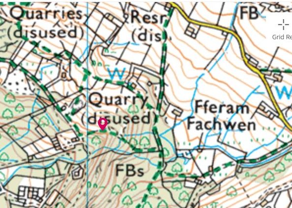
There are six quarry sites recorded within the estate.
Two of these, Boundary SH57506140 PRN20078 (that is the boundary
between old Fachwen and Vaynol land) by Cei Llydan station on the
modern lakeside railway and 20079 Ladas at SH578610 (no archaeology
record) were started after the Vaynol acquisition and there is little
to be seen, and no public access.
The remainder are
Vaynol (originally Fachwen) SH57856155 PRN20080 is the only quarry
which was definitely worked after 1840. DinD p60 illustrates that it
was much expanded in the late C19th and it is still active on OS map
1914 1:10560. This is because it was the only quarry on the estate
which was capable of accommodating an incline down to the lakeside
railway after the Vaynol acquisition.
Chwarel Isaf SH57896140 (no archaeology record) “old quarry”
1914 1:10560
Lloc SH58206190 PRN20085 . This last falls within the addition to the
estate from the enclosure award, it looks on the ground as if there
was a “drag” going up to the main road/tramway.
There is also an undocumented trial adit at SH58046132.
Documented history
First mention of the possibility of quarrying is in 1830 (XD2/16867),
when a William Roberts of Llanwnda, applies to Lord Newborough for
rights to quarry for slate. The letter implies there are no workings
there at the time. A similar application is made on behalf of an Owen
Michael the following year (XD2/16924). In 1832 (XD2/17096) the agent
for Lord Newborough comments “I will see what can be done with the
Bachwen people, though it is very probable that they will be like
dogs in the manger, unable to do anything themselves, and unwilling
to let anyone else” – although the context doesn’t show whether
this is a reference to quarry leases or tenants. Something has
started by January 1834 (XD2/ 17569), which refers to rents
being paid for the Bachwen Quarries, amongst others. A month later
Thomas Prichard, Lord Newborough’s agent, states (XD2/ 17593) “Mr
Shelton is going on very well at Fachwen so far, but the prospect is
not very good.” 5 weeks later he comments (XD2/ 17629) that a
Mr. John Roberts, who had other substantial quarrying leases on the
Glynllifon estate, “was willing to take the positions at
Fachwen quarry” but two days later (XD2/ 17633) Edward Shelton
“also wants the whole of Fachwen ” and again (XD2/ 17636) “Mr.
R. could come to some agreement with Mr. Shelton about Fachwen, if he
could secure a proper rent”. Later that year Pritchard, “has to
go to Fachwen with Mr. S to arrange how to go on with the quarries as
we intend to begin them shortly”. These arrangements are confirmed
by the fact that the land transfer of 1840 (XD2/6620) refers to a
lease taken out by Edwin Shelton from Lord Newborough in 1834 for
quarrying for 21 years, XD2/19077. In the Spooner survey (DinD,
Vaynol 7142) the only two quarries shown are “Shelton and Greaves”,
clearly the location of what was subsequently called Vaynol, and
probably Fronhyfryd., but not Chwarel Isaf or the others . Since
Chwarel Isaf is squarely in the way of the survey route, it seems
pretty certain it did not exist then. Presumably “Isaf” refers to
the fact it is slightly lower down the hillside than “Shelton and
Greaves”, and was started later. There were difficulties getting
the slate out, and in August 1840 Shelton commented “Fachwen will
only pay with a railroad connection” (XD2/19301). It looks as
though he stopped work. Lord Newborough comments that “Mr. Smith’s
agents have ferreted out everything connected with Bachwen, and know
that E.S. discontinued working the slate there”. Shelton, who was
in partnership with Joseph Greaves of Llechwedd fame, was most
unhappy about the Vaynol takeover of the estate, even before the
transfer was completed, see XD2/19070, XD2/ 19572, XD2/ 19626,
XD2/ 19651 –and threatened legal action “will not hesitate to
stop the railway from going through Fachwen”. Eventually,
once the railway is open in 1842 (XD2/ 20360) Shelton decides he
“must surrender his lease of his Lordship’s quarries [because of
a recession in the industry]. The old quarries are gradually becoming
more expensive to work and less productive” – the actual surrender
is at ZDBE/3405. Thereafter any working that took place was part of
the Dinorwic undertaking as a whole. It seems pretty clear from the
correspondence that Shelton was in difficulty making his quarry pay,
and that Thomas Ashetton Smith knew this and wanted the land mainly
to enable the lakeside railway to go through. Shelton after
threatening legal action for “breach of quiet enjoyment” of his
lease, eventually gives in, and thereafter the quarries are worked
using an incline to the lakeside railway.
Tenancies/houses
Plas or
Fferam fachwen
This entry refers to the farm now buried under the (landscaped) slate
tip of Domen Fawr, not the apparently later Fferam Fachwen about 100m
to the west.
There are several items of correspondence in the Newborough estate
papers referring to the original tenant (and it would seem sub tenant
members of the family).
In 1819 it is asserted that the “tenant of Lord Newborough’s farm
at Fachwen exercised an exclusive right on part of the common
immediately above that part which on plan is allocated to Thomas
Ashetton Smith, as well as lot 138 [ie Bigil] which is allocated to
Lord Newborough. He feared that the right had not been exercised for
20 years, but was done 20 years before the passing of the Act , which
he hoped would enable Lord Newborough to regain his right”. The
significance of this, as I understand it, is that rights exercised on
common land more than 20 years before its enclosure, overrode the
award. By this time Thomas Assheton Smith, lord of the manor of
Dinorwic (hence the name becoming attached to the quarry) and owner
of the Vaynol estate, who had worked Chwarel Fawr and Allt Ddu
quarries for many years, had opened up the main quarry site familiar
to us today. So presumably by now Lord Newborough, like all the
landowners in the area, was looking to develop slate quarries, and
was hoping this assertion would help him. Issues about who profits
from quarrying probably underlie most of the subsequent
correspondence. Such quarrying as took place is detailed below.
In the 1851 census there are two households in the
area of the present Fferam Fachwen, so one could still be the old
Plas:
471
Fachwen
Griffiths
William
Head
M
59
Labourer
CAE, Llanbeblig
471
Fachwen
Griffiths
Jane
Wife
M
51
CAE, Llanbeblig
471
Fachwen
Griffiths
Jane
Daughter
U
20
CAE, Llanbeblig
471
Fachwen
Williams
Ioan
Head
M
45
Quarryman
CAE, Llanddeiniolen
471
Fachwen
Williams
Ellinor
Wife
M
43
CAE, Llanddeiniolen
471
Fachwen
Williams
Ellinor
Daughter
U
16
CAE, Llanddeiniolen
471
Fachwen
Williams
William
Son
U
13
CAE, Llanddeiniolen
471
Fachwen
Williams
Hugh
Son
U
11
Quarryman
CAE, Llanddeiniolen
471
Fachwen
Williams
Morris
Son
U
9
Quarryman
CAE, Llanddeiniolen
471
Fachwen
Williams
Ann
Daughter
U
7
CAE, Llanddeiniolen
471
Fachwen
Williams
Jane
Daughter
U
4
CAE, Llanddeiniolen
471
Fachwen
Williams
Mary
Daughter
U
4m
CAE, Llanddeiniolen
In the following years
there is a record in the Glynllifon papers of disputes regarding
tenants and quarrying, as detailed below
Correspondence shows that one William Morris, who died in 1841 at age
78, was under Lord Newborough’s ownership the sole tenant and had
lived on the estate all his life, as had also his father. Before the
sale a letter from Evan William Morris (apparently the son) complains
that his farmhouse is in a very decayed state, the outbuildings need
rebuilding and they have nowhere to thresh what little corn he has
obtained through perseverance and industry. It is stated that this
house lies on the estate “on the other side of Afon Fachwen”,
which clearly verifies the tradition of a Plas Fachwen under Bonc
Fawr. The tithe map shows the property as being down by the river,
not far from the present road end. Another letter just after the sale
from Hugh H Morris reminds Lord Newborough that when he applied to
his Lordship to become the tenant of lands in Fachwen
he [Lord N.] gave him permission to repair the house and, in the
event of an alteration, was to mention this assurance. He now asks
his Lordship to bring him to the notice of Mr. Assheton Smith’s
agent, Mr. O. Roberts,and annexes a petition (20 August 1838). At
present, he and his father hold land in Fachwen under his uncle,
William Morris. Owing to the pressing need of their house to be
repaired or rebuilt he wishes to have the security of becoming his
Lordship’s tenant.
The son only remained tenant briefly after the estate was sold to
Vaynol, but agreed to being transferred to Tai Isa, Pentir, much to
his disadvantage he later claims. Presumably this arrangement was in
pursuance of the policy of leasing plots to quarrymen. He claimed to
have borne the cost of “enclosing a park” of about 100 acres
“from the common”, which must refer to the additional 102 acres
of the enclosure award , (ie the purple line on the map) and the
correspondence reflects an unsuccessful attempt to recover the cost
from Lord Newborough, who asserted he had paid for the work himself.
Ty Newydd
First appears unequivocally on the Llanddeiniolen enclosure award map
of 1814 (plan C), but not named: if the sketch is to be trusted it
appears to be the original small cottage only. The award allocates it
and the surrounding fields to Lord Newborough. There
is reference to a house on this land occupied by one John Williams,
which Evan Williams claimed to have bought for £33. John Williams
himself wrote to Lord Newborough in 1832 about reducing the rent from
£2 to £1 per year “on account of improvements he had made”. The
only house clearly identified in the enclosure plan (not by name) is
Ty Newydd/Tyddyn Bach, so this is probably the house concerned,
It features in both the 1841 and 1851 censi. 1841 – Griffith Jones
25 quarryman, Jessie 25, Margaret 3, Anne 1, Mary Evans 14. It
reappears, with the two storey and barns extensions but not the
dairy, in the large book of estate plans Vaynol 4194 page 4, where
the house is called Ty Newydd but the smallholding (about 4.5 acres)
is described as Ty Ddyn Bach. In this plan the present access track
is now shown and individual fields are named with their present
boundaries. An extract from this document has been published. Most of
the smallholdings in this area were made subject of new leases by the
estate in 1869, but there is no record in the documents of one for Ty
Newydd/Tyddyn Bach
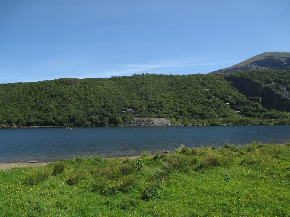
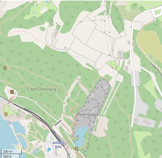
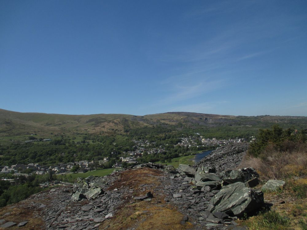
Apart from a weekly shop for food on a Sunday morning, this is my only “outing” of consequence at the moment, whereas in normal circumstances it might not merit an entry here. There are several ways of walking down the hill from Dinorwig, so you can ring the changes more easily than your shorter daily walk. This is the hillside viewed from the bottom, the old Dinorwic quarry hospital can be seen on the far side of the lake, and Vivian quarry on the right hand side. I live beyond the top of the treeline.
On the way down, you pass the bottom of Vivian quarry, which was a
later nineteenth century excavation separate from the main quarry
workings, here is the view from the access road to the Quarry
hospital, although the sunlight is now so strong that the greenery is
rather overwhelming.
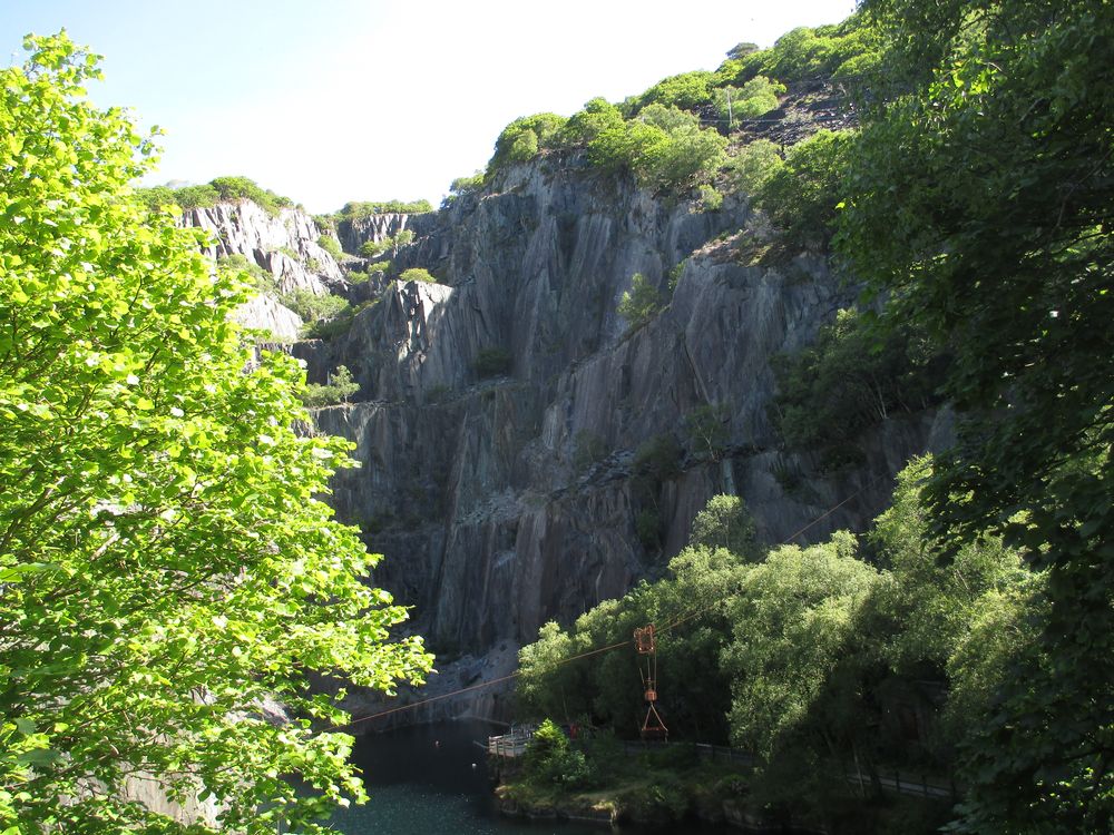
Nowadays
it is used as a diving centre (closed of course at the moment), and
also rock climbing takes place here though there have been some rock
falls in the recent years. The rusty metal “Blondin”
suspended across it is a modern recreation for show purposes, not
there when it was a working quarry. A little further on, again
obscured in lush vegetation, is the point where two high voltage
transmission lines come down the hill across the quarry to a point
where they go underground across the valley floor, before reemerging
on the far side of the valley.
The nearer post, with the transformers on it, is the local
electricity supply at 12000V, the rather obscured one behind it is
the 32000V National Grid supply to Caernarfon – I got this
information some years ago from an engineer marooned on a pole near
my house during some work on the line. They are shown on
OpenStreetMap, but not Ordnance Survey. They must have been a daring
installation whenever they were first done, and not the easiest lines
to maintain, although I believe engineers are used to far worse.
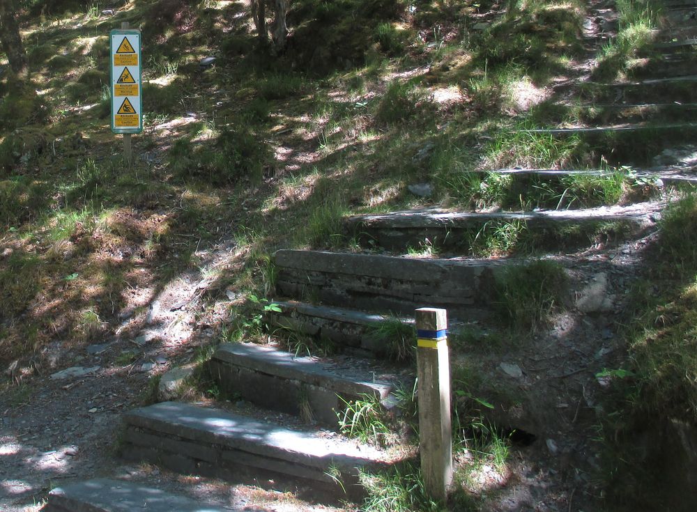
Returning from the village the same way you come to the steps used by
the quarrymen to get to the various levels of Vivian as they were
opened up, which now carry a health and safety notice about their
potential dangers.
Technically these steps form the public right of way up the hill at
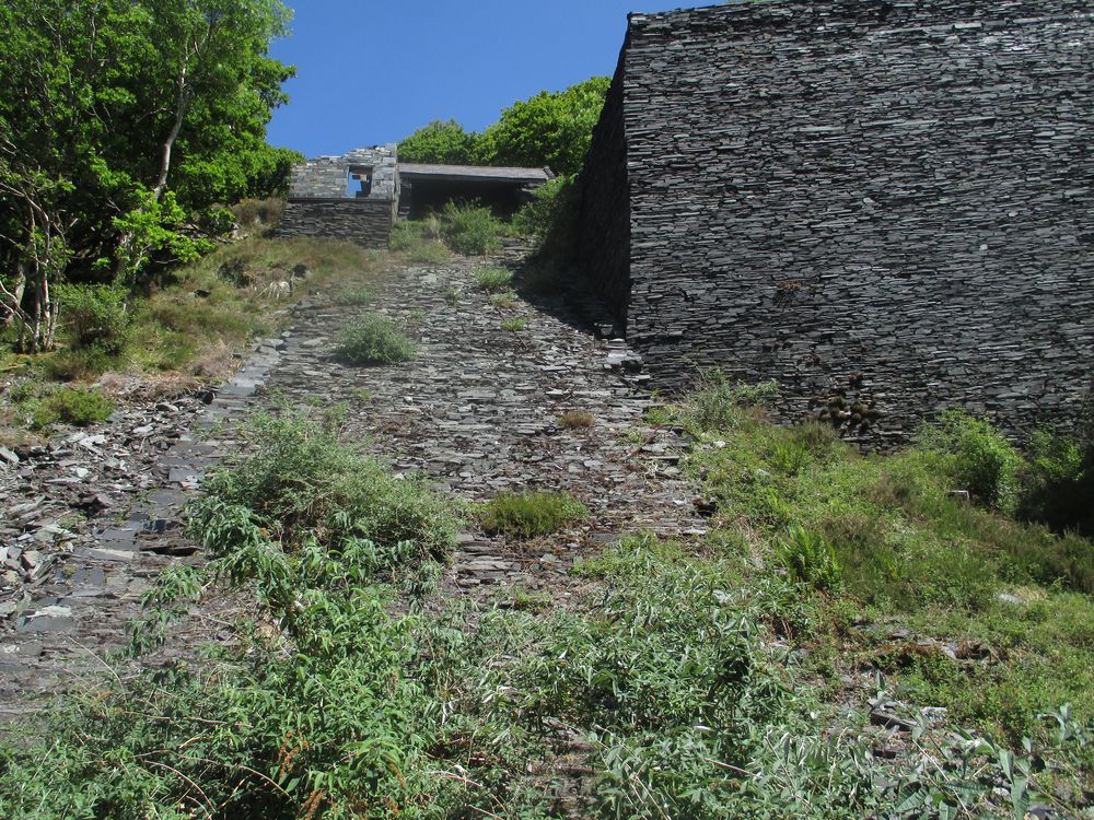
this point. You then come to the first level, and the incline for the
quarry comes into view. This is it going uphill, although the
photograph doesn’t do justice to how steep it is!
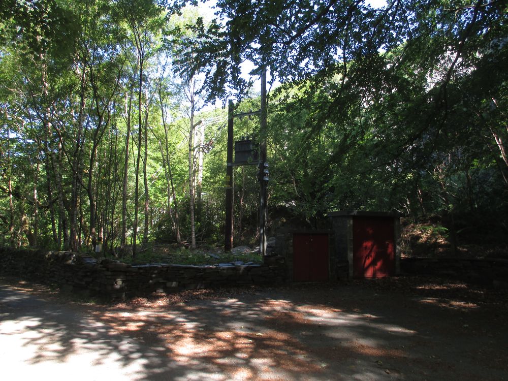
Nearby, now nearly lost in the woods, is one of the toilets that was
installed for this quarry, the first such examples I am aware of. My
house itself had such a “Ty Bach” installed when we first moved
in, superseded by a septic tank in 1974, which has never had to be
emptied.
As you move up the hill, you come to the “Doctor’s Road”, so
named because it was the route by which the doctor (on horseback I
would presume) travelled from his house in Dinorwic village down to
the hospital when it was first built around 1870.
In
fact the route is older than that, because it is shown in a sketch
map from the Vaynol archives in 1788, and may have been one of the
first routes for getting slate from the quarry to lakeside, a “drag
route” ie by sledge, before inclines were created. The road
was
cut in half by the development of Vivian, and similarly
for
the western end of the proposed Spooner tramway mentioned in my
previous article – which is still the public right of way. Clear at
this point that it has been constructed but never used. It ends a
couple of hundred metres further on.
You are most of the way up now, and a little further you go through
an abandoned gateway which means you have nearly reached the top of
the hill. It was a hot day and hard work. The change in the weather
at the time of writing makes it a distant memory.
I live in a relatively remote area, and from time to time problems
will arise with telecommunications. I had a landline for 20 years but
abandoned it 8 years ago after the internet speed dropped to 136Kps
and I got a penalty charge for a fault which was eventually traced to
a failure in the network. I appealed to the relevant ombudsman at the
time and got the charge revoked, but decided to abandon the line
completely. It has since snapped in a gale and I have no plans to
have it back.
I have had a mobile phone contract since the very early days, 1994 as
near as I remember, so I had the use of that, but not a smartphone in
2012, so I negotiated a contract with a different provider for a
dongle to use with my laptop, and these have been my link to the
outside world ever since.
In the UK the provision of mobile communications is demand-led, and
here it is low relative to urban areas. It is cheaper for the phone
companies to piggy back on an existing communications mast than set
up individual cell sites, and since television masts are ubiquitous
that happens here. All very well unless a digger (backhoe in US
English, I’m told) digs through the electricity supply for the
mast, as happened here once some years ago. For TV I have digital
Freeview, so the first test you conduct when mobile communications
fail is to check whether you still have a TV signal!
The other characteristic here is that coverage is provided by one
cellular site only because of the hilly terrain, whereas in towns a
device can usually switch to a different source automatically.
As of Friday morning my phone signal has failed completely. My dongle
signal is affected, but it can pick up a signal from about 7 miles
away under some circumstances – that’s around a bend in the
hills, so it’s not ideal. Also, when sites become busy with traffic
they automatically reduce the range of their coverage, on the
assumption that fringe areas will get an alternative from somewhere
else.
So I have sporadic internet access, enough to establish that the
phone companies know there is a problem and don’t know when they
can fix it.
There are of course many places round here, Snowdon Horseshoe,
Nantgwynant which have no mobile coverage anyway.
You will only see this blog if I can sneak in an upload when traffic
is quiet….
Update
Problems disappeared as mysteriously as they arrived at 1245 today
GMT.
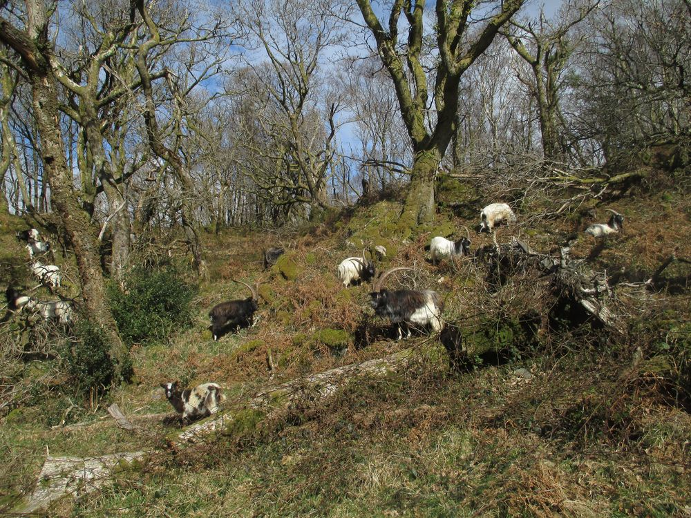
There are two categories of wild goat in this part of the world. The most well known are the Kashmiri goats on Great Orme, Llandudno which have recently achieved national and international publicity by roaming the streets of the town. Although presented as a recent development, it happens on a smaller scale quite regularly since there is no physical barrier to their coming down into the town. As the wikipedia entry notes, these were a gift to Queen Victoria in 1837. The web references tell you all you need to know about them.
Not so well known are the flocks of feral goats that are found here in Padarn Country Park and the Glyderau, the range of mountains that start above my village and run south east into the Snowdonia National Park. They also graze further south to the village of Beddgelert where they can be a nuisance, as everywhere, for their capacity to eat everything in sight in the gardens, and indeed jump out on the narrow stretch of the road A498 in front of your car, although of course sheep will do this as well. https://www.welshmountainzoo.org/animals/welsh-mountain-goat
These are described as feral on the assumption they were originally domesticated, possibly even deliberately let loose to graze, since they can survive in the wild rather better than most species of sheep. The earliest reference I can find to their existence here is by Samuel Johnson, the compiler of the first English dictionary. He visited Dolbadarn Castle in 1774 (though he does not mention it by name), and his diary of the journey says that a 10 yr old girl who was in the party with him counted 149 of them. If you do a web search for “feral goats Snowdonia” you will get lots of references.
These flocks migrate of their own accord from the mountain tops in summer to valleys in the winter and vice-versa, which would explain the widespread practice of transhumance around the world, including here (see the section on Wales in the wikipedia article, and the widespread Welsh Hafod (summer pasture/house) and Hendre (winter pasture/house). They are an everyday sight in the woods here at the moment, but I would expect them to start moving up the mountain in the near future. Quite how their “clocks” decide the timing of the move I do not know.
There are also wild ponies on the mountains a few miles away.
For those of you outside the UK, the Ordnance Survey is the official mapping provider in England, Scotland, and Wales. (There are separate providers for Northern Ireland and Republic of Ireland). The Wikipedia entry gives a summary of its history which officially started in 1791 as a response to the Napoleonic Wars, although there are precursors in the military surveys carried out in Scotland after the failed Jacobite rising of 1745.
When I was growing up in London my father ran a business maintaining RAF airfields in the south of England, this entailed a lot of travelling to oversee the work. He had a Standard Vanguard (I have the receipt for its purchase), roughly the equivalent of an Audi in today’s terms. He used to bring me back Ordnance Survey maps of the places he had been to, which I still have, so I learned how to read them from about the age of about five upwards. A lot has changed since then! There is a vast online resource of maps now, and if you look at the Geograph website I referred to in my last post you will see at the bottom of the page “More links for this image” which has a range of references which can keep you entertained for hours.
My village has a bit of an identity crisis. To summarize:
Dinorwig is the original Welsh name, the only title used on Ordnance Survey maps, and by the local authority to which it belongs, Gwynedd County Council. But if you are ordering goods on line, the UK Post Office database will only recognize Dinorwic. What’s this all about?
The true Welsh version means “hill fort of Orwig”, which refers to a prominent structure a few miles away, (OS grid reference SH54986528) best seen from aerial photgraphs at https://coflein.gov.uk/en/site/95283/details/dinas-dinorwig-hillfort. This is on private land and not open to the public. This was in use before the Roman occupation of Britain, but continuing as a settlement by the original population during it. The most likely derivation of “Orwig” is from the Iron Age tribe occupying the area at the time of the Roman invasion, expressed in Latin as “Ordovices”. A Roman road runs very close to it, and there is also some slight evidence of a Roman fort in the vicinity, a typical configuration in the occupation of Roman Britain which had advanced to this area by AD61. As so often happens, “Dinas Dinorwig” is a tautology since Dinas and the stub Din- have the same meaning. It’s also common for place names to move a few miles over the years. There was also a Llys (“royal court”) Dinorwig at SH56296322 on the site of a modern caravan park, of which there is nothing to be seen now.
After the formal annexation of Wales into England in 1536, many of the Welsh names took on an English form. What is now the village of Dinorwig is a creation of the slate mining industry in the nineteenth century, and as the quarry was English owned it became called Dinorwic. Now the quarry has gone and devolution has taken place, useage is reverting to the correct Welsh spelling, except for the Post Office postcode database, which doesn’t yet recognize it.
The identity crisis is reflected in the current population, I am an incomer born and brought up in England, and so are quite a few of my neighbours. There is still a Welsh population, but as in many parts of North Wales many of the properties are now either second homes or holiday lets. More of that some other time.
Just a brief entry today, to publicize this popular website (no, I don’t get a commission!) It is an effort by many volunteers to provide photographs for every Ordnance Survey grid square in the UK and Ireland, and even has an offshoot now for Germany. There are over six million photos on it, including several hundred for my village – see
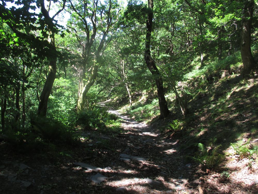
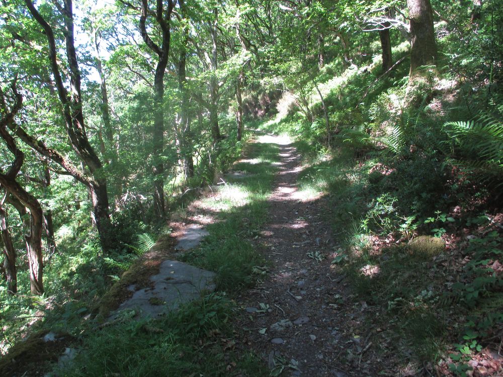
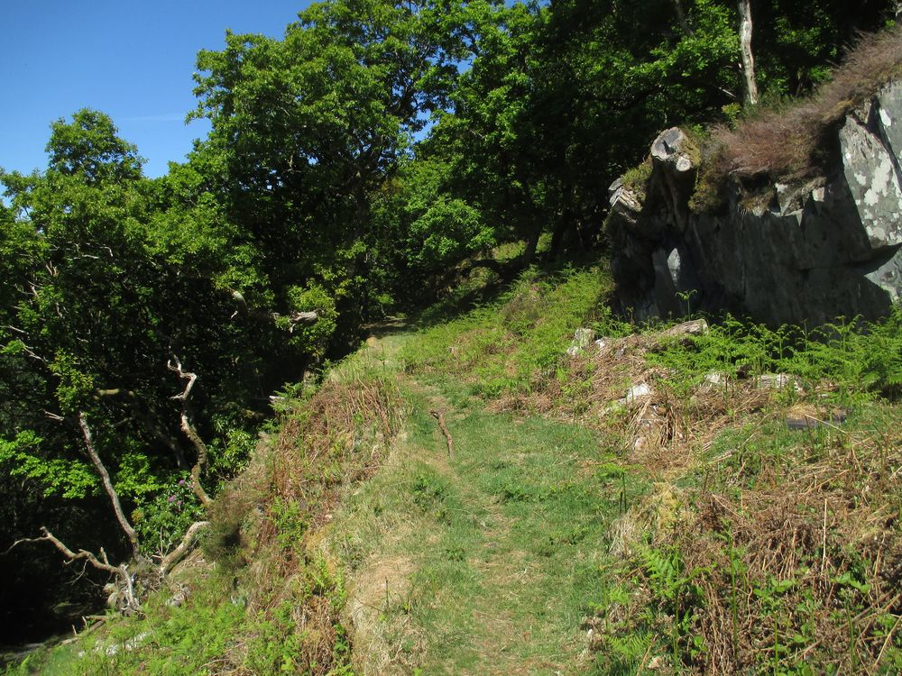
Once a month I walk down through Padarn Country Park to collect a prescription and any other small items of shopping I might need. Usually in a concession to age I come back by bus, but the vagaries of an emergency timetable mean this is no longer practicable, so after a brief packed lunch I decided to go up the hard way, the number one incline of the Dinorwic Quarry. Successful expedition, 5 miles in 4 hours. Here are some of the photos I took on the way back.
This is a section of the “Spooner survey” taken at SH58856018, the top of the incline I climbed being to the left. This replicates a photograph of the same location on page 26 of Damien Carrington’s book “Delving in Dinorwig”, which describes this venture, an abortive plan to build a railway from the quarry to the Menai Strait at Port Dinorwic (now Y Felinheli). Only a few hundred metres of the line were actually built.
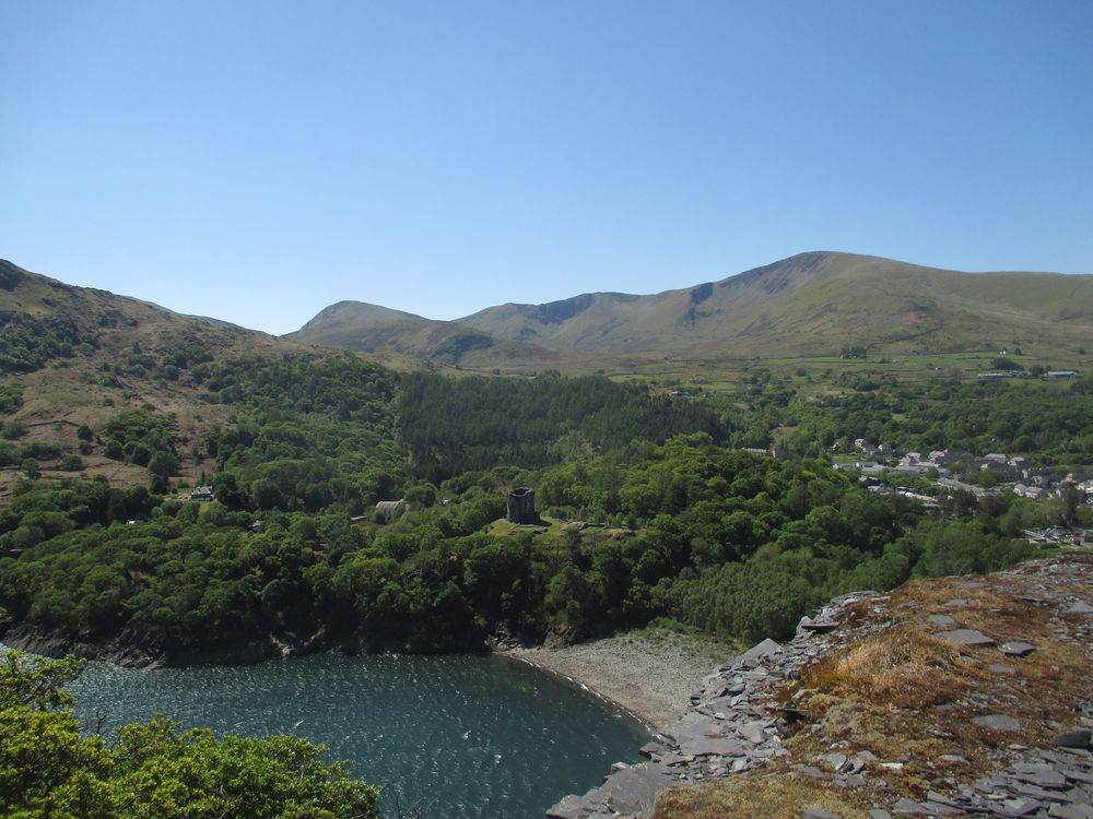
The incline levels off at this point to allow trucks to pass each other, and you now have views to the south. This is the well known Dolbadarn Castle
and a view of Llanberis itself
T
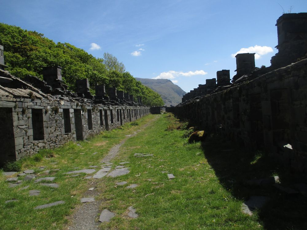
The incline then resumes and the next photograph is of Anglesey Barracks, which was built to house workers who lived in Anglesey but worked at the quarry six days a week. These buildings are listed
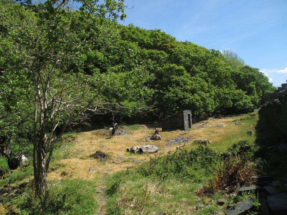
with the usual collection of feral goats behind. These come down to this level during the winter and spring, but will soon work their way back up the mountain tops
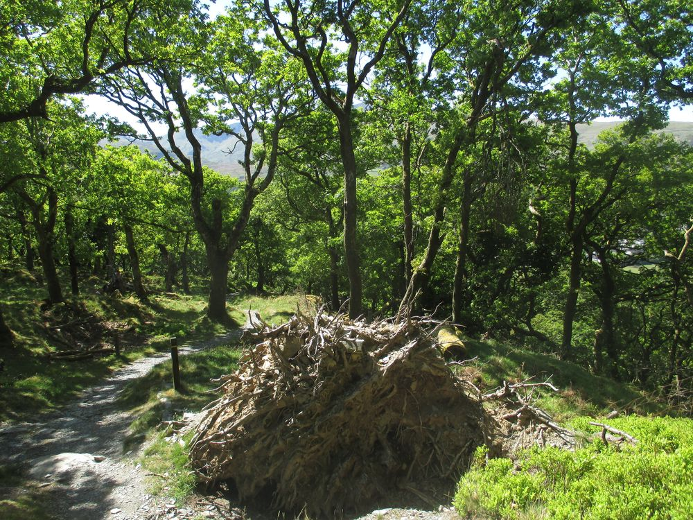
left the incline at this point and walked up the normal path to the village. Here is the remains of an uprooted tree, about two hundred of these were blown down in the “Beast from the East” storm in March 2018, which left some of us without electricity for 48 hours. The sun doesn’t always shine here!
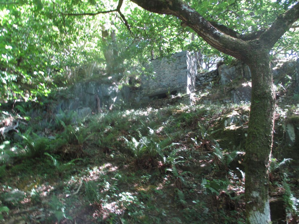
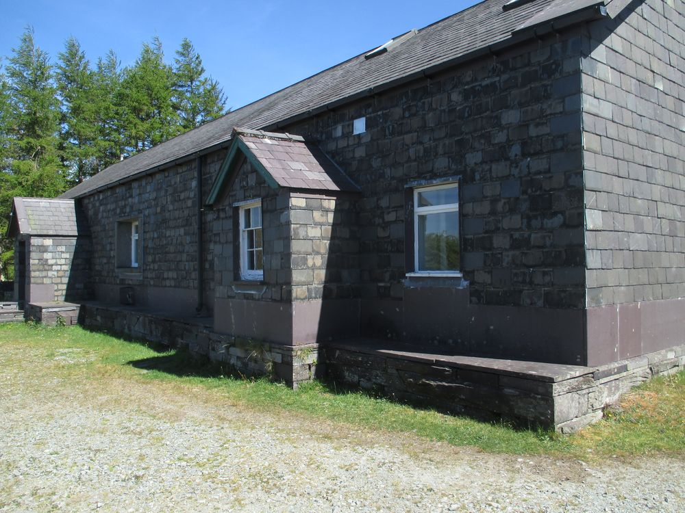
Up at the top of the hill there is the old gunpowder store for the quarry, which is now a climbing hut for the Manchester climbing club. You can see slates on the vertical walls to keep the rain out, but you can’t see that the walls inside are actually cavity walls, since damp gunpowder is a menace. Possibly the earliest example of cavity walling.
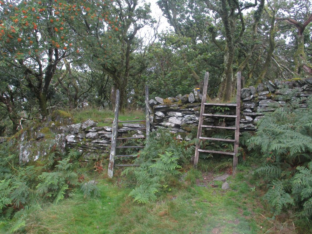
And finally the last stile of the walk on the way home, Victorian and modern versions, take your pick!
A lovely but tiring walk, and quite legitimate under lockdown regulations.
I am completely new to blogging, so be charitable to me if I blunder about a bit learning how to do this.
I am John Byde and have been using Vivaldi browser for several years, so that is how I came to be here. My computer system is Linux Mint 18.3 following my divorce from Windows 7 because of a persistent virus problem. I am 77 years old and live on my own in a rambling stone cottage on a mountainside within view of Snowdon. I had a conventional British “classical” (ie Latin and Greek) education at a public school in London, then a theology degree at Oxford. Such IT skills as I possess are entirely self taught.